Noch haben wir keinen Login, aber ...
... wir prüfen die Einführung eines Login. Ihre Meinung ist dabei von unschätzbarem Wert und hilft uns, die beste Lösung zu entwickeln.
Ihre Antworten sind anonym und helfen uns, Ihre Erwartungen best möglichst zu erfüllen. Bitte nehmen Sie sich einen Moment Zeit, um an unserer kurzen Umfrage teilzunehmen.
Vielen Dank für Ihre Unterstützung
Zürich Tourismus
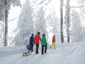
Hüttchopf
As you approach the Tannen saddle, you can see the rocky Hüttenchopf protruding above the forest and meadows.
From the Hüttchopf, as well as on the way to the Alp Scheidegg, where a picturesque mountain restaurant is awaiting, you are treated to a spectacular panorama of the thickly wooded headwaters of the lower and upper Töss, towards the Säntis and, to the north, Lake Constance.
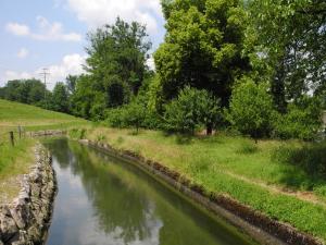
The descent takes you over the Josenberg ridge, and then across the slope down to the Sagenraintobel ravine. Finally, the path follows a varied route along the Schmittenbach stream.
Details
- Total length: 12 km (7.5 miles)
- Level of difficulty: easy
- Physical fitness: easy
© SchweizMobil
Opening Hours
Open on These Days
- Mo
- Tu
- We
- Th
- Fr
- Sa
- Su
Address & Contact
| Distance | |
|---|---|
| Zürich Main Station | 29.7 km |
| Zürich Airport | 29.7 km |